REVIEW · MOAB
Lake Powell & Canyonlands National Park Scenic Charter
Book on Viator →Operated by Redtail Air · Bookable on Viator
Red rock looks different from 8,000 feet. This Lake Powell and Canyonlands Scenic Charter turns the big Moab scenery into a fast, focused flight with live commentary and clear views of some famous (and hard-to-reach) features.
I like the way the tour uses window seats for everyone, so you’re not stuck peering around strangers. I also like the live narration through headsets, which makes the geology and river stories click instead of feeling like random canyon spotting.
One watch-out: this is a sky tour, not time on foot. If you’re hoping for hikes, overlooks, or ranger-style stops, you’ll need to pair this with ground time on your own.
In This Review
- Key highlights I’d target
- Why this Moab charter flight works so well
- Before you fly: the Moab check-in setup
- Lake Powell from above: side canyons, geology, and scale
- Canyonlands National Park: Island in the Sky to the Needles District
- Cataract Canyon, the Colorado River story, and why it’s so intense
- Glen Canyon Dam and Lake Powell’s “bank account” function
- Horseshoe Bend: that 270-degree river turn
- Rainbow Bridge: big dimensions you can actually picture
- Small group + headsets: how the tour stays personal
- Timing and duration: a 3-hour hit of high-value views
- Price and value: what $2,313 per person buys you
- Who should book this flight
- Should you book Lake Powell & Canyonlands Scenic Charter?
- FAQ
- How long is the Lake Powell and Canyonlands scenic charter?
- Where do we meet for the tour?
- Are window seats provided?
- Is there live narration during the flight?
- What kinds of landmarks are included in the route?
- What happens if the weather isn’t good?
Key highlights I’d target
- Window seats for everyone, so the best views are actually shared
- Headsets + live pilot narration, turning sights into real geography
- Small-group feel with only your group participating
- Lake Powell to Canyonlands in one loop, saving hours of driving and planning
- Rainbow Bridge from above, including scale details you don’t get on many viewpoints
- Cataract Canyon and the Colorado River story, with rapids, dam impacts, and river bends in one route
Why this Moab charter flight works so well
Moab’s good at making you choose: you can drive and hike, or you can enjoy the views from a distance. This charter adds a third option that’s wildly efficient. In a few hours, you get aerial “map views” of the places people usually only see in fragments from viewpoints and trailheads.
The big value is perspective. From the air, Canyonlands stops being a set of pullouts and becomes a real system: cliffs, river cuts, domes, and spires arranged like a puzzle you can finally understand. Same with Lake Powell’s side canyons. Up close, it can feel like one huge water-and-rock scene. From above, the branching shapes and hidden corridors become obvious.
Also, the tour is designed for comfortable viewing. Window seats for everyone matters more than it sounds. On many flights, half the group ends up craning or waiting for turns. Here, you’re set up to take in the views for the whole experience.
You can also read our reviews of more tours and experiences in Moab.

Before you fly: the Moab check-in setup
Your journey starts back at 94 W Aviation Way in Moab. The activity ends back at the same meeting point, which keeps things simple after you land.
Inside the terminal, you’re provided complimentary water. That’s a small thing, but it’s smart when you’ve been traveling all day or you’re planning to hit trail time afterward. You’ll also have mobile ticket access and confirmation received at booking time.
One practical note: this is offered in English, so narration is in English through the headsets. If you’re traveling with family or friends, that’s helpful for keeping everyone on the same page about what you’re seeing.
And yes, this is set up as a private tour/activity, meaning only your group participates. That usually translates to a calmer experience and less rushing around other groups.
Lake Powell from above: side canyons, geology, and scale
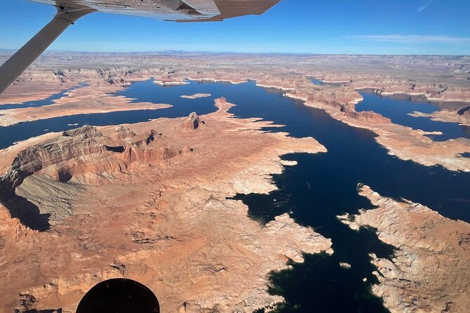
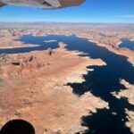
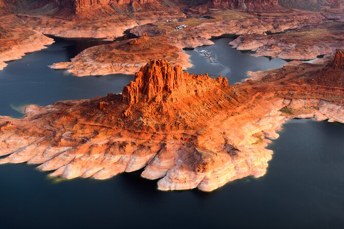
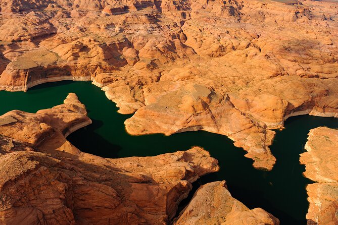
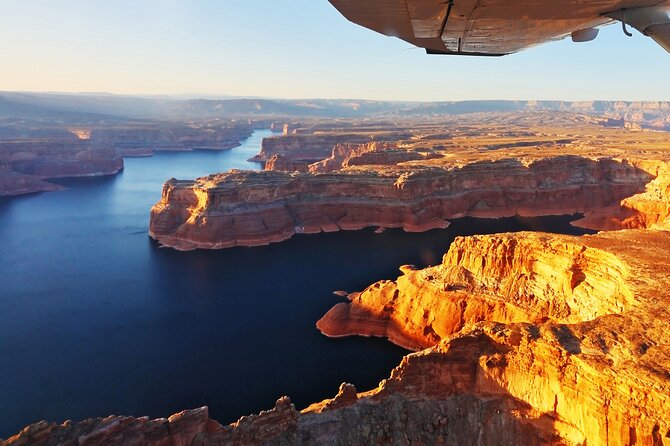
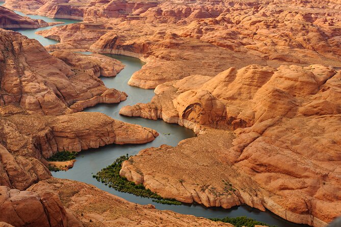
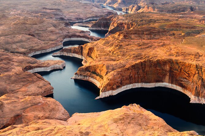
You start with Lake Powell, and you get about an hour there. Even if you’ve seen Lake Powell from the road, the aerial view changes the whole feeling of the place. You don’t just see water and rock. You see the branching canyon walls that create the reservoir’s maze.
It’s a great stop for two reasons.
First, the aerial perspective shows how the lake “fits” into the canyon system. Side canyons become readable features instead of vague shapes. You can also spot how the terrain shapes the water’s outline, which helps connect the dots between what you’ll see on the water and what you’d otherwise miss from land.
Second, the pilot’s narration adds the missing context. The tour highlights Lake Powell’s history and geology as you fly over the area, which is the best way to avoid the trap of sightseeing without learning anything. You’re not just looking down; you’re being guided through what formed the terrain and how the river system became what you see today.
If your goal is to take great photos, this is one of your best windows to do it. Aerial framing makes it easier to capture the big pattern: water channels, canyon walls, and the sense of depth all at once.
Canyonlands National Park: Island in the Sky to the Needles District
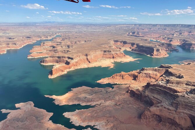
After Lake Powell, the flight shifts to Canyonlands National Park, with about 1 hour 30 minutes devoted to it. Canyonlands is famous for being split into distinct districts, and the air view makes that division easier to grasp than it is from ground-level overlooks.
In the northern district (Island in the Sky), you’ll look for the massive cliffs and the way the land drops toward the Colorado and Green Rivers, which border it on both sides. One of the tour’s key points is that these cliffs rise roughly 1,000 feet high above the rivers. From the air, you don’t have to guess. The scale is right there.
You’ll also see serpentine drainage systems carved into the terrain below the cliffs. That’s one of those details that sounds like geology trivia until you spot it from above and realize how much “hidden plumbing” exists on the plateau.
Two other features worth aiming your eyes at:
- Upheaval Dome at the northern end
- The confluence of the two rivers toward the southernmost point of the district
Then the flight moves to the Needles District, and this is where Canyonlands gets more colorful in a way that’s easy to appreciate from the sky. You’ll see pink and white bands in spires and cliffs, plus the area’s famous arch country.
The Needles District is known for arches like Angel Arch and Druid Arches. The tour also includes views of Elephant Arch, Kirk Arch, Wedding Ring Arch, and Castle Arch—features described as remote and difficult to reach by hiking. From the airplane, you don’t have to choose between your legs and your curiosity. You get the big picture and the name recognition at the same time.
If you like photography, this is your “signature” section: spires, bands, and arches all in the same flight block.
A small consideration: because these are arch country views, you’ll want to stay flexible. Aerial visibility depends on flight path, light, and cloud cover. You won’t control that, so keeping your eyes open and your expectations photo-realistic helps.
Cataract Canyon, the Colorado River story, and why it’s so intense
Next, you’ll fly over Cataract Canyon—described as containing about 14 miles of rapids, with difficulty up to Class V. That’s a big detail, and it matters because it reframes what you’re seeing below. This isn’t just scenic river winding. It’s a dangerous, technical section of the Colorado River, and the canyon is isolated and hazardous.
The tour information also points out extreme water level fluctuations in this area. That’s part of what makes Cataract Canyon so famous among river runners and so intimidating to anyone imagining a casual drift. From above, you may not feel the danger—but you can see the tightness of the canyon and understand how the river’s energy becomes concentrated.
What I like about this segment is that it ties the landscape to real-world consequences. Rivers aren’t just pretty lines on a map. They control access, safety, and what kinds of activities are even possible.
Glen Canyon Dam and Lake Powell’s “bank account” function
Flying over Glen Canyon Dam is a strong moment because it adds the human story to all that geology.
The dam is described as the second highest concrete-arch dam in the United States, behind Hoover Dam. Hoover Dam is noted as 726 feet, and Glen Canyon Dam is positioned as the runner-up in height. That kind of fact does two things: it gives you a reference point, and it makes the structure feel more real when you’re seeing it from the air.
But the most useful takeaway is the dam’s role in water storage. Lake Powell’s storage capacity is described as 25.16 million acre-feet, and the tour explains it as a “bank account” of water drawn on during drought. In practical terms, that’s why cities, industries, and agriculture in the West can keep going when rain and snow don’t arrive the way everyone hopes.
This segment helps you understand the bigger theme of the whole flight: the Colorado River system is not only a geological machine. It’s also a managed resource, and that management reshapes what you see in Lake Powell.
Horseshoe Bend: that 270-degree river turn
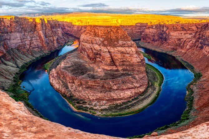
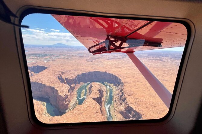
You’ll also pass over Horseshoe Bend, which is one of the most recognized spots in Glen Canyon National Recreation Area. From above, the tour highlights how the Colorado River meandered over time—making wide bends while always seeking the path of least resistance.
Then comes the geological twist. The tour explains that about 5 million years ago, the Colorado Plateau uplifted and trapped the meandering rivers in their beds. Over time, the rivers cut through the uplifted layers of sandstone. At Horseshoe Bend, that process created a roughly 1,000-foot deep and 270-degree horseshoe-shaped bend in Glen Canyon.
If you’ve only seen Horseshoe Bend from the viewpoint, you’ve seen the curve. From the air, you see the curve’s relationship to the canyon walls, the surrounding terrain, and the river’s long-term behavior. It’s the kind of detail that makes your later photo look sharper because you understand why it looks the way it does.
Rainbow Bridge: big dimensions you can actually picture
Finally, the flight includes Rainbow Bridge, described as one of the world’s largest known natural bridges, with a 275-foot span and 290-foot height. That’s already impressive, but the tour info goes further with details that help you visualize the bridge as more than a symbol.
At the top, it is noted as being about 42 feet thick and 33 feet wide.
From the ground, many “large” landmarks feel like silhouettes. From above, you can better understand how the bridge connects rock walls and how wide the opening really is. This is the part of the flight that tends to feel most awe-friendly because it combines geometry and scale in a way that’s easy to grasp quickly.
One tip for your own experience: keep your camera ready, but also give your eyes a second after you identify the feature. In aerial views, the first pass is for spotting; the second pass is for really seeing the structure.
Small group + headsets: how the tour stays personal
The tour includes headsets so you can clearly hear the narration. That’s crucial on any plane, but especially in canyon country where you want context while you look.
The pacing also benefits from the small group setup. Since only your group participates, you’re less likely to be dealing with interruptions or crowd choreography. If you like being able to focus on what you’re seeing without constant distractions, this design helps.
And the window seats for everyone tie in with this. You’re not stuck scanning for the one good view angle. You can sit comfortably and watch the pilot lead you through the route.
In at least one standout experience I learned from a pilot named Brandy, the narration made the flight feel especially smooth and informative. I can’t guarantee who you’ll fly with, but it’s a good sign that the pilot commentary is a core part of what people remember.
Timing and duration: a 3-hour hit of high-value views
The total duration is listed as about 3 hours. That’s a sweet spot for sky sightseeing in this area. Long enough to cover multiple districts and famous features, short enough that you’re not mentally exhausted by the time you land.
A smart way to treat the timing: think of the flight as a “visual orientation tool.” You’ll see Lake Powell, learn how the rivers and canyon systems relate, and then connect that to Canyonlands’ cliffs and arch country. Afterward, it’s much easier to decide where to spend time on foot.
If you plan a busy itinerary in Moab, this flight can act like the map you didn’t know you needed. It turns your next day into targeted exploring instead of guesswork.
Price and value: what $2,313 per person buys you
At $2,313 per person, this is not a budget add-on. It’s a premium experience, which means the value has to be judged on what you gain compared to driving and hiking.
Here’s what you’re paying for, in plain terms:
- Access to multiple major landmarks in one short time window, including Canyonlands districts and arch country
- Uncrowded, private-group structure, with window seats for everyone
- Live pilot narration through headsets, so you’re learning while you’re watching
- A bird’s-eye perspective that you simply can’t replicate from standard viewpoints
If you’re the type of person who wants to make the most of limited time in Moab, or you’re traveling with someone who can’t do long hikes, this price can start to make sense fast.
On the other hand, if you have plenty of time and your priority is being outdoors on foot, you could spend less and see a lot from roads and trailheads. This charter isn’t trying to beat hiking on cost. It’s trying to beat hiking on viewpoint efficiency and “big-picture” understanding.
Who should book this flight
This charter fits best if you:
- Want high-impact scenery without spending a whole day driving
- Appreciate geology and river history but don’t want to be stuck reading signs
- Travel as a group that wants together time with a private setup
- Prefer comfortable viewing from window seats rather than managing viewpoints in a crowd
It may not be your match if you’re hoping for a hands-on outdoor day with stops for photos on foot. This is an air tour, and the reward is visual and educational, not trekking.
Should you book Lake Powell & Canyonlands Scenic Charter?
Yes—if your goal is to see both Lake Powell and Canyonlands in a single, well-guided flight, and you value clear narration + window seats over long ground time. The route covers the key “wow” features you’d otherwise have to piece together across multiple days, and it adds context that makes the scenery click.
If weather in the area worries you, remember that this kind of experience requires good conditions. But when the day works, this is one of the most efficient ways to get a real sense of how the Colorado River system shapes what you’re seeing around Moab.
FAQ
How long is the Lake Powell and Canyonlands scenic charter?
The total duration is listed as approximately 3 hours.
Where do we meet for the tour?
The meeting point is 94 W Aviation Way, Moab, UT 84532, USA, and the tour ends back at the meeting point.
Are window seats provided?
Yes. The tour includes window seats for everyone.
Is there live narration during the flight?
Yes. The tour includes live narration, and headsets are provided so you can clearly hear it.
What kinds of landmarks are included in the route?
The tour highlights Lake Powell and Canyonlands National Park, and also includes aerial views of Cataract Canyon, Glen Canyon Dam, Horseshoe Bend, and Rainbow Bridge.
What happens if the weather isn’t good?
This experience requires good weather. If it’s canceled due to poor weather, you’ll be offered a different date or a full refund.