REVIEW · WEST GLACIER
Glacier National Park Going-to-the-Sun Road Self-Guided Tour
Book on Viator →Operated by Shaka Guide Apps · Bookable on Viator
Your phone narrates the Sun Road.
This self-guided audio tour turns your car into a moving guide, with GPS directions and offline maps so you can focus on the drive instead of fiddling with your screen.
I like that it works as a true hands-free road trip plan: audio narration starts automatically as you drive, and it helps you time the pullouts. I also like the value because it’s $7.99 per group (up to 15 people) for one tour per vehicle, not per person—plus it’s a private experience. The one real drawback to plan for: it does not include park entrance fees or parking fees, so you still need to budget for the standard costs of getting onto the road and stopping.
In This Review
- Key things to know before you press play
- How the Shaka Guide audio tour guides your drive
- West Glacier setup: the last full-service town moment
- Apgar Visitor Center: plan, refill, and jump to the shuttle area
- Lake McDonald highlights: first views, rainbow rocks, and a lodge built in 1914
- McDonald Creek Falls pair: two cascades and one trail choice
- Trail of the Cedars to Avalanche Lake: easy loop, big reward hike
- From Red Rock Point to Bird Woman Falls: viewpoints that change your eye level
- Logan Pass and optional Continental Divide hikes
- Lunch Creek, Jackson Glacier, and the Siyeh Pass area: water stories and ice lessons
- St. Mary side: falls, Sun Point views, and a perfect end-of-day rhythm
- Visitor Center finish plus a little-known ranger stop
- Price and value: $7.99 per group, but don’t forget park costs
- The tech side: when it’s great and when it’s annoying
- Who should book this Going-to-the-Sun audio tour
- Should you book? My take on the decision
- FAQ
- What is the duration of the Going-to-the-Sun Road self-guided tour?
- Where does the tour start and end?
- Does the tour include park entrance fees or parking?
- Do I need internet or data during the drive?
- Is this tour private for my group?
- What languages are available?
Key things to know before you press play
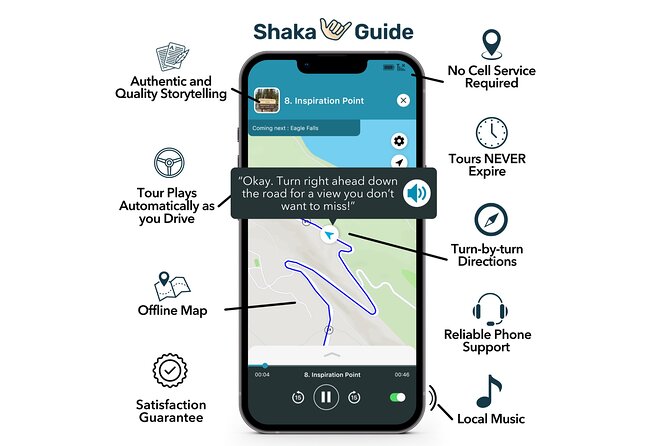
- Automatic audio + GPS turns: narration and directions play as you drive, which keeps you from missing key stops.
- Offline map: no constant data needed once downloaded ahead of time.
- Private-by-vehicle: one tour per group up to 15, so it feels less like a mass-produced bus day.
- Stop-by-stop pacing: the route is designed around quick pullouts plus a couple of longer hikes.
- Flexible routing: you can pause, resume, and in practice reconnect if you turn around due to weather or visibility.
How the Shaka Guide audio tour guides your drive
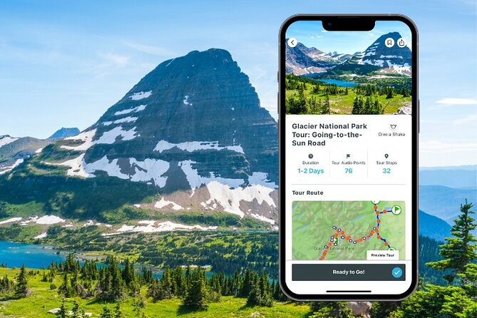
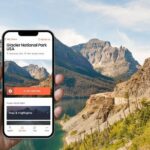
This is a self-guided mobile audio tour for Glacier National Park’s Going-to-the-Sun Road. You download the app, redeem a code from your email, then launch the tour from the starting point you choose. After that, the narration plays automatically as you drive, and the GPS provides turn-by-turn directions.
The practical win here is mental load. Instead of trying to read your phone while searching for pullouts, you get told what’s coming and what to do when you arrive. The tour also works with an offline map, so you’re not dead in the water if cell service flickers.
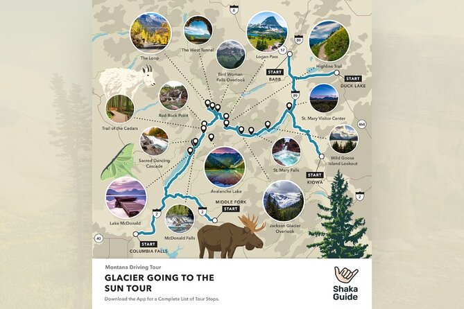
The tour is designed for a long day—about 10 to 11 hours—so the pacing matters. Some stops are quick photo or viewpoint breaks, while others are long enough to feel like mini-adventures.
You can also read our reviews of more tours and experiences in West Glacier.
West Glacier setup: the last full-service town moment
Most days, you’ll start in West Glacier, right outside the west entrance. It’s the gateway town and your practical checkpoint: if you need coffee, gas, or bear spray, this is the last full-service option you’ll see before the longer drive on Going-to-the-Sun Road.
You’ll spend about 15 minutes here. Don’t treat it like a sightseeing stop. Use it like a logistics stop—top off the tank, grab snacks, and make sure you’re ready for the park day ahead.
After you get moving, the tour transitions toward Apgar, where you can reset again.
Apgar Visitor Center: plan, refill, and jump to the shuttle area
Next up is Apgar, centered around the Apgar Visitor Center. Plan to spend about 30 minutes. This is where you can browse exhibits, do trip planning, hit the restroom, and refill water—plus it’s where you can board the Going-to-the-Sun Shuttle.
Even if you’re staying in your own car, this is still a smart place to take your bearings. The Visitor Center is a natural “pause button” for a long road day, especially if you want to adjust your hiking plans or timing.
Then the route begins your Lake McDonald focus.
Lake McDonald highlights: first views, rainbow rocks, and a lodge built in 1914
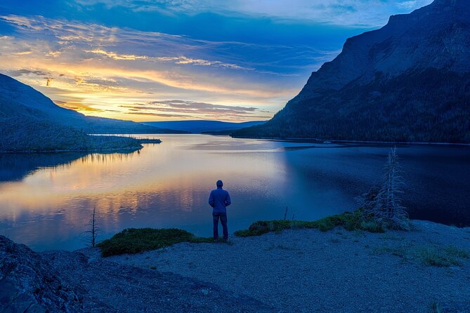
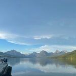
You’ll roll into the Lake McDonald stretch with your first major payoff: views of Lake McDonald, the park’s largest lake. This stop is brief—around 5 minutes—but it matters because it sets the tone for the whole day.
Right after, you’ll stop at Apgar Beach on Lake McDonald for about 10 minutes. This is the quick walk along the pebbly shoreline where you can admire the famous rainbow rocks. It’s not a long beach day, but it’s a great “stretch your legs” reset.
A bit more down the road, you get a calmer break at Sprague Creek Campground (about 5 minutes). It’s shady and lakeside, with picnic tables—an easy place to eat a snack if you packed something simple.
Then comes Lake McDonald Lodge, with about 30 minutes. The tour notes it was originally called the Lewis Glacier Hotel, built in 1914 by prospector John Lewis. It’s an example of park architecture using local stone and cedar. Even if you’re not in museum mode, this stop gives you a sense of how long people have been coming here.
McDonald Creek Falls pair: two cascades and one trail choice
Two of the best “water stops” sit along McDonald Creek, and the tour treats them as related highlights.
First is McDonald Falls (about 30 minutes). You’ll get the rushing water on the McDonald Creek Trail, where the blue-green tone and white foam are especially striking on clear days. Give yourself a little time here—this isn’t just a look-from-the-car moment.
Then you’ll visit Sacred Dancing Cascade (about 30 minutes). It’s the second cascade, and you have two ways to experience it:
- stop at roadside pullovers, or
- walk the McDonald Creek Trail to see both cascades together.
If you turn around at McDonald Falls, the total time for the two waterfalls can be about one hour and roughly a mile. That’s a great option if you’re saving your legs for longer hikes later.
After waterfalls, the tour shifts into forest walking.

Trail of the Cedars to Avalanche Lake: easy loop, big reward hike
The Trail of the Cedars gets about 1 hour in the plan. It’s an easy, flat half-mile loop, known for Western Red Cedar and Hemlock “rainforest” feel. This is one of the nicest stretches of “gentle hiking” on the route because it doesn’t punish you before a bigger day.
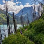
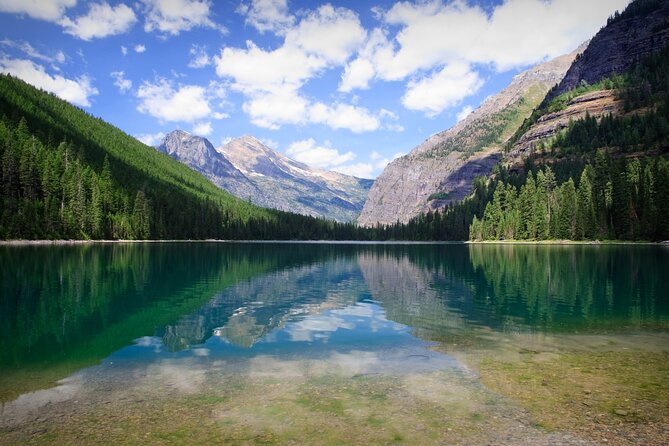
Many people then push onward to the main event: Avalanche Lake. Your allotted time is about 2 hours. The trail from the Trail of the Cedars Trailhead runs about 4.5 miles to the lake area, moving through rainforest, passing multiple waterfalls, and eventually reaching a crystal-clear glacial lake.
The tour notes that the lake reflects Avalanche Peak, which is why this hike earns its reputation. If you’re pacing yourself, treat this as the hike you either go all-in on—or you shorten and come back to finish the drive.
Once you’re back in the car, you’ll switch from hikers’ rhythm to viewpoint stops.
From Red Rock Point to Bird Woman Falls: viewpoints that change your eye level
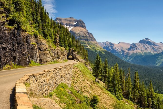
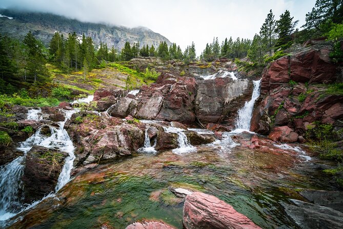
Next is Red Rock Point (about 10 minutes). The tour explains the red color comes from compacted clay and oxidized iron, and you get clear-blue water from McDonald Creek cascading over the red Grinnell rocks. It’s a quick stop with a strong visual contrast.
Then you’ll reach Mount Cannon (about 5 minutes). This overlook is aimed at the triple-peaked mountain. The tour mentions it was formerly called Mount Goat until 1901, when two newlyweds became the first people to summit it.
After that: Garden Wall for about 5 minutes. This is where you first get a view toward the McDonald Valley before heading into higher altitudes. It’s one of those “the road is changing” moments—your eyes get higher, and the scale starts to feel bigger.
Then it’s a major hiking hub at The Loop Trailhead (about 30 minutes). The Loop is described as the steepest hairpin turn on the entire road. The trailheads here connect to some of the park’s most famous routes, including The Loop, Granite Park, and the Highline.
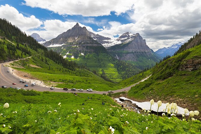
From there, you’ll visit Bird Woman Falls (about 10 minutes). The falls are fed by snowmelt from Mount Oberlin and Mount Cannon, and the tour flags them as especially spectacular in late spring and early summer. At 960 feet, the falls are across the valley—so you’ll want to pause long enough for your viewpoint to make sense.
A quick breath follows at Paradise Meadow (about 5 minutes), with spring wildflowers called out in the plan. Then you’ll come to Oberlin Bend (about 30 minutes), where there’s a short boardwalk walk—about 10 minutes—with views of Logan Pass and the McDonald Valley, and sometimes mountain goats.
From meadow and goats, the route climbs to its high point.
Logan Pass and optional Continental Divide hikes
Logan Pass is the highest elevation point on the road in this plan—about 6,600 feet—with about 1 hour allocated. This is the place for iconic trails and the Logan Pass Visitor Center. Use the visitor center for restrooms and orientation, but don’t feel stuck inside; the pullouts around here are part of the reason the road is famous.
One of the big optional trail names the plan points you toward is the Highline Trail. The tour describes it as 11.8 miles, following the Continental Divide with alpine meadows, rugged peaks, and diverse wildlife. Since the Highline is a long hike, treat this as an add-on only if you’re already confident in your hiking time budget.
After Logan Pass, you transition to more viewpoints and shorter walk options.
Lunch Creek, Jackson Glacier, and the Siyeh Pass area: water stories and ice lessons
The tour gives you a stop at Lunch Creek Pullover (about 10 minutes). It’s hidden in a hairpin turn, with water cascading down Pollock Mountain. There’s a short walk down to an observation deck—perfect if you want a quick sound-and-sight break without eating your entire day.
Then comes Piegan Pass as a hike suggestion. The plan notes it’s popular but definitely full-day, at over 9 miles. It follows along Siyeh Creek through spruce-fir forest and rises toward a barren, rocky pass between the Siyeh and Cataract Mountains. This is the kind of trail that requires real planning time; use the audio cues to decide whether you have the legs and daylight.
Next is Jackson Glacier Overlook (about 10 minutes). This is where you can see Jackson Glacier, described as the park’s 7th largest remaining glacier, and you’ll also get a little about glaciers and their fate in the park. It’s a short stop that adds context to everything you’ve been seeing.
On the St. Mary side of the park, the tour shifts toward waterfalls and lake views.
St. Mary side: falls, Sun Point views, and a perfect end-of-day rhythm
The plan includes a short hike suggestion: the St. Mary Falls Trail. It’s about 1.5 miles round trip with less than 200 feet of elevation change. If you want to see more, the tour suggests continuing down to Virginia Falls, for a total of about 3 miles round trip.
Then you’ll have a quick hiking option at Siyeh Pass (about 30 minutes). It’s great paired with St. Mary’s Falls. The plan notes it’s just over a mile to Baring Falls and back.
The viewpoint rhythm continues at Sun Point, described as a promontory looking over St. Mary Lake. The tour also points you to the Sun Point Nature Trail, about 2 miles (or 3 kilometers), with views of St. Mary Lake, Baring Falls, and Red Eagle Mountain.
For photography practice, the tour includes Wild Goose Island Lookout (about 10 minutes). It lists mountains you should be able to pick out left to right—Red Eagle, Mahtotopa, Little Chief, Dusty Star, and Citadel—so it’s not just a generic scenic stop.
Next is The Narrows (about 5 minutes). The plan points out the Narrows and the Golden Staircase, noting the Narrows is the lake’s narrowest channel and referencing the retaining wall built to support the banks.
Then it winds down toward the water again:
- Rising Sun Boat Dock (about 5 minutes): dip your toes, watch boaters, or just enjoy the lake activity.
- Rising Sun Picnic Area (about 5 minutes): a quick lakeside break before your exit.
Visitor Center finish plus a little-known ranger stop
You’ll end the east-side loop with Saint Mary Visitor Center (about 30 minutes). The plan includes time for the bookstore and exhibits, a film on park history, and practical basics like restrooms and water bottle refills. Even if you’re not planning to watch the film, the visitor center is a useful reset before you head back.
Then comes what the plan calls a historic ranger station stop: Saint Mary Historic Ranger Station (about 30 minutes). It’s described as a secret stop about 500 feet down Beaver Pond Trail, built in 1913, and tied to some of the earliest park rangers. This is a nice final payoff because it adds a human scale to all the big scenic moments you just drove through.
When you’re done, the activity ends back at the meeting point.
Price and value: $7.99 per group, but don’t forget park costs
At $7.99 per group (up to 15 people), the pricing is hard to beat if you’re road-tripping in one vehicle. You’re essentially paying for one guided audio plan per car, not per person, which is where value shows up.
But here’s the key reality check: the tour does not include park entrance fees or parking fees. The stops themselves are listed as admission ticket free, but you still need to handle the standard park costs of getting onto Going-to-the-Sun Road and leaving your car at pullouts or lots.
Think of this tour as a way to reduce guesswork and tighten your pacing—not as a replacement for park admission.
The tech side: when it’s great and when it’s annoying
When the setup goes smoothly, this kind of audio tour can be a joy. Your route feels calmer because the app gives you stop timing and GPS cues. The tour is also built to use offline maps, which helps on a road like this where signal can be hit-or-miss.
The catch is phone reality. One common pain point is logging in and downloading the app steps, especially if you’re not comfortable with multiple installs or redeem codes. Plan extra time before you hit the road, and use strong Wi-Fi to download the tour ahead of time.
Also, make sure your expectations match what you’re buying. This is an audio guide with GPS directions, not a ticket that covers the park entrance or access fees. If you’re coming in hoping the audio purchase includes the right to drive the park road for free, you’ll feel burned.
Who should book this Going-to-the-Sun audio tour
I’d point you toward this tour if you want:
- a hands-free way to learn the major stops along Going-to-the-Sun Road,
- a route plan that includes both quick pullouts and a couple of real hikes (like Avalanche Lake),
- and one simple tool for the whole car rather than everyone paying separately.
I’d skip (or at least be cautious) if:
- you hate phone-based setup and might struggle with downloading or redeeming the tour,
- you expect it to include park entrance or parking,
- or you only want a very short list of stops and don’t want a long day.
Should you book? My take on the decision
If you’re doing the Going-to-the-Sun Road in one day and you like knowing what you’re looking at, I think this audio tour is a solid buy. The best parts are the stop timing, the way it helps you plan for viewpoints and hikes, and the simple fact that it keeps your attention on the road instead of your maps.
Just be honest with yourself about logistics. Budget for park entrance and parking, and give yourself time to get the app ready before you start driving. If you do that, you’re likely to come away feeling like you spent your money on smoother sightseeing—not on another headache.
FAQ
What is the duration of the Going-to-the-Sun Road self-guided tour?
The tour takes about 10 to 11 hours.
Where does the tour start and end?
It starts in West Glacier, MT, USA and ends back at the meeting point.
Does the tour include park entrance fees or parking?
No. Park entrance fees and parking fees are not included.
Do I need internet or data during the drive?
No constant internet is required. The tour includes an offline map, and you’re advised to download the tour using strong Wi-Fi before you go.
Is this tour private for my group?
Yes. It’s a private activity, and only your group will participate.
What languages are available?
The tour is offered in English.