REVIEW · TEXAS
Big Bend National Park Self Guided Audio Tour Guide
Book on Viator →Operated by Shaka Guide Apps · Bookable on Viator
Big Bend can feel huge and intimidating at first, but this GPS audio route turns it into a clear, do-able day. You get turn-by-turn directions and audio stories that guide you stop to stop, with offline maps so you’re not hunting for signal inside the park. The itinerary leans hard into the park’s big scenery—Santa Elena Canyon views, Chisos Basin highlights, and the Rio Grande border area.
What I like most is how practical it is for real travel days. You can start when it suits you, follow the GPS route at a pace that won’t bully you, and still learn why each place matters—from pioneer homesteads to desert life and fossils.
One consideration: a couple stops depend on trail conditions. Tuff Canyon Overlook has been temporarily closed due to rock slides, and Santa Elena Canyon’s trail involves a water crossing that may be a bad idea in high water or heavy mud.
In This Review
- Key Highlights I’d Aim For
- A GPS-Activated Audio Route That Makes Big Bend Feel Organized
- Price and Time: One Tour for Your Vehicle With Park Fees Separate
- Sam Nail Ranch, Sotol Vista, and Mule Ears: Quick Stops That Pay Back Fast
- Tuff Canyon Overlook to Santa Elena Canyon Trail: Short Walks With Real Terrain Notes
- Castolon to Dorgan Sublett and Homer Wilson Ranch: Frontier Homes and Photo-Friendly Vistas
- Chisos Basin Day Plan: Visitor Center, Window View Trail, and Lost Mine Trail Choices
- Panther Junction, Fossil Discovery, Dugout Wells, and Hot Springs: Ecology, Deep Time, Desert Oases
- Rio Grande Village, Nature Trail, Boquillas Crossing, and the Canyon Border Walk
- What the Best Reviews Get Right: Flexibility, Easy Use, and Helpful Stories
- Should You Book This Big Bend Self-Guided Audio Tour?
- FAQ
- How much does the Big Bend self-guided audio tour cost?
- How long does the tour take?
- Does the tour include Big Bend National Park entrance fees?
- What do I need to use the tour in the park?
- Will the audio play automatically while I drive?
- Can I start the tour whenever I want?
- Are parking fees included?
- Do I need a passport for Boquillas?
- What if a stop like Tuff Canyon is closed?
Key Highlights I’d Aim For
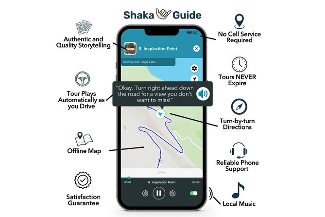
- GPS-activated narration while you drive, so you don’t have to babysit your phone
- Offline map and GPS that works without Wi-Fi or data inside the park
- One price per group up to 15, which can be great value for families and small friends trips
- Mix of quick lookouts and short hikes, so you can match effort to heat and energy
- Border-area payoff at Boquillas, with legal entry info and viewpoints right from the U.S. side
- Useful “what to expect” trail cautions, especially for water crossings and flood-prone drainages
A GPS-Activated Audio Route That Makes Big Bend Feel Organized
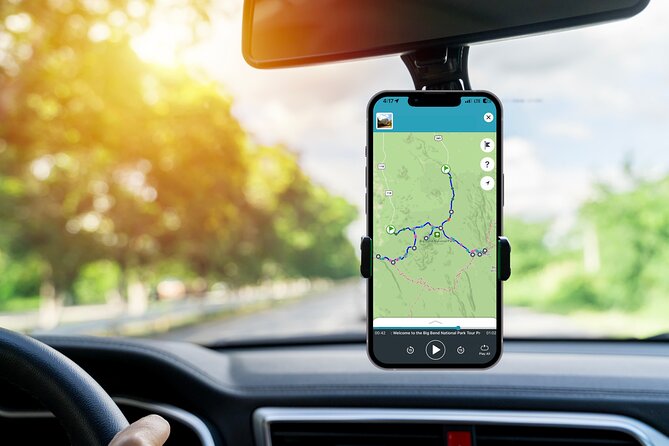
This isn’t a live, schedule-chasing bus tour. It’s a self-guided audio tour built around driving. As you roll along the roads, narration can play automatically using GPS, and you’ll get turn-by-turn directions to each stop.
That matters in Big Bend because distances add up fast. One of the easiest ways to waste a day is driving toward “the next thing” without a plan—then arriving too late for the walk, or realizing you missed the best viewpoint because you didn’t know where to pull over. This format helps you get your bearings fast and keep moving efficiently.
You’ll also appreciate the flexibility. Your start time is customizable, and you can pause and resume on your own schedule. Even if you decide to skip one stop (or spend longer at another), you’re not trapped in someone else’s timeline.
Price and Time: One Tour for Your Vehicle With Park Fees Separate
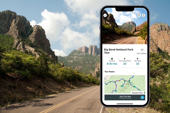
The tour costs $12.79 per group for up to 15 people, and it’s designed for a single vehicle/group experience. Typical duration is about 8 to 9 hours, depending on how many short hikes you actually do.
Two money notes that affect the real total:
- The tour does not include park entrance. There’s also mention of parking fees not included.
- The listing states an entrance fee of $30.00 per booking, so budget for that on top of the audio tour price.
For value, the best comparison isn’t per person—it’s per vehicle. If you’re traveling with family, a couple friends, or multigenerational groups, one audio tour covering up to 15 can make the cost feel minor compared to guided tours that charge per head. And because the tour never expires, you can use it again on a future trip idea.
Sam Nail Ranch, Sotol Vista, and Mule Ears: Quick Stops That Pay Back Fast
This start is about setting context early. Big Bend isn’t only rock and views—it’s also people, farming attempts, and frontier life in a harsh landscape.
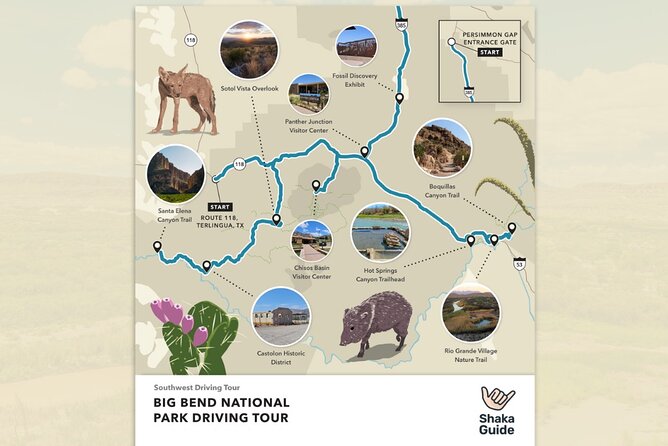
Stop 1: Sam Nail Ranch is a short walk with a big story behind it. Sam Nail built a two-room house here in 1916 with his wife Nena, raising livestock and planting pecan, walnut, and fig trees. The trail from the road is easy—about a half-mile round trip—and it leads you to what’s left of those orchards and the house site. This is a great “warm-up” stop because it’s manageable even if you’re visiting during hotter parts of the day.
Stop 2: Sotol Vista is a short pull-off with a long view. It sits just off Ross Maxwell Scenic Drive and gives you a 360-degree feel over much of the western half of the park, including Santa Elena Canyon in the distance. This is where you’ll start to understand scale. You’ll look out and think: okay, this canyon is the main event.
Stop 3: Mule Ears Viewpoint is pure payoff with almost no effort. Park, look, and enjoy the unusual volcanic rock formation that resembles mule ears. It’s brief—about 5 minutes—but those quick visual hits are perfect when you want the day to stay flexible.
Practical tip: these early stops are low effort, so I’d use them to judge your energy level for the rest of the drive.
Tuff Canyon Overlook to Santa Elena Canyon Trail: Short Walks With Real Terrain Notes
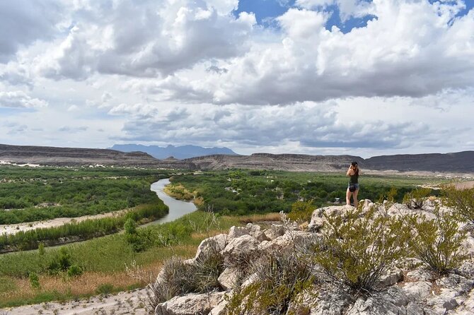
From here, the tour shifts from quick viewpoints to places where you’ll feel the terrain.
Stop 4: Tuff Canyon Overlook focuses on a small canyon with three overlooks. There’s a trail from the southern parking lot down into the canyon, under a mile round trip and about an hour. Important consideration: at the time of writing, this stop was temporarily indefinitely after rock slides. In other words, don’t plan your entire day around it—if it’s closed when you arrive, you’re not stuck.
Stop 5: Castolon is history near the U.S./Mexico border. You’ll walk through remnants of an early 20th-century community, including the Alvino House and La Harmonia store, which interpret life for a multicultural community about a century ago. The visitor center is worth your time here—not just for facts, but for practical help like learning about the area and stocking up on snacks and supplies.
Stop 6: Santa Elena Canyon Overlook is an easy add-on. It’s about 5 minutes, with a view of the canyon mouth. This is a good choice when you want the drama of Santa Elena without committing to a deeper hike.
Stop 7: Santa Elena Canyon Trail is the bigger play. The mouth of the canyon is close—just a few dozen steps from the parking area—with walls around 1,500 feet high. The trail into the canyon is doable, but the trailhead requires a water crossing. That’s the big caution: in high water or heavy mud, you might decide not to cross.
If you do reach the trail on the other side, it’s about 1.6 miles round trip and considered easy, aside from a couple of step-heavy spots. If you’re visiting in wet seasons or after storms, I’d treat this as a “check conditions, then decide” moment rather than a guaranteed hike.
Castolon to Dorgan Sublett and Homer Wilson Ranch: Frontier Homes and Photo-Friendly Vistas
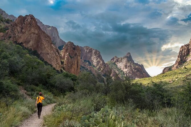
Big Bend’s history often feels scattered—small places where the past still shows through. These stops help you connect those dots.
Stop 8: Dorgan Sublett Trail is an easy 1-mile round trip to remnants of two pioneer homes. The Dorgan adobe house is especially good for photographers with a strong backdrop: rock formations plus the Chisos Mountains. If you like your hiking to come with an obvious subject, this one delivers. It’s short enough to fit into a day without turning into a fitness test.
Stop 9: Homer Wilson Ranch is another “see it two ways” stop. You can access a small observation deck from a pull-off to see the old rancher’s home, or take a 1-mile round trip hike that takes about 30 minutes. It’s easy overall, but it crosses two drainages that may flood. That means you should think like a desert hiker: even if the day looks calm, flooding can change conditions quickly after rain.
The audio narration is especially useful here because these places can look like “ruins in the desert” unless someone explains what you’re seeing.
Chisos Basin Day Plan: Visitor Center, Window View Trail, and Lost Mine Trail Choices
Now you move into a part of Big Bend where weather can change the whole experience.
Stop 10: Chisos Mountains is where you can easily spend the day. The higher altitude often means cooler temperatures than the rest of the park, which can make hiking feel far more comfortable. Start at the visitor center for a trail map and consider the lodge for food.
If you want the easiest “must do,” aim for the 0.3-mile Window View Trail, a paved walkway to a view of The Window. It’s short, scenic, and doesn’t require a lot of stamina.
If you’re feeling more ambitious, the 5-mile round trip Lost Mine Trail is also a popular choice and is described as moderately difficult. This is a good segment to match to your group’s abilities—do it if you’ve got energy, skip it if the heat is winning.
Panther Junction, Fossil Discovery, Dugout Wells, and Hot Springs: Ecology, Deep Time, Desert Oases
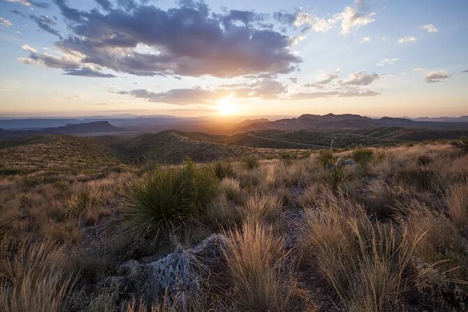
This stretch balances “Big Bend isn’t just scenery” with places you can enjoy without major hiking.
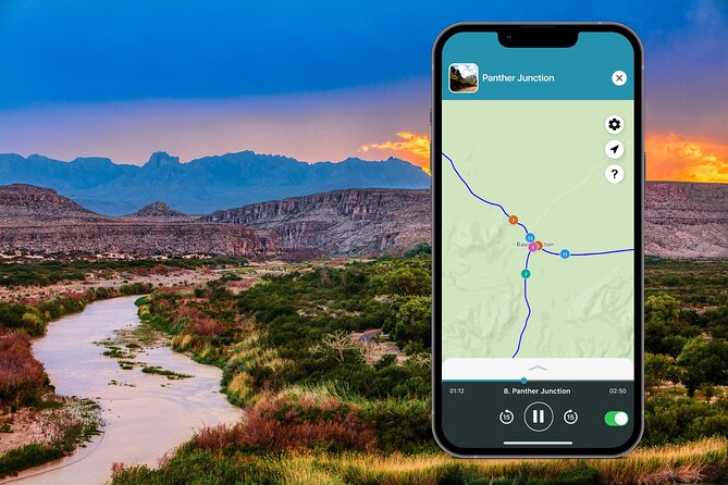
Stop 11: Panther Junction Visitor Center is your hub. Watch the park video, browse exhibits, check out the gift shop, and step outside into a small garden of local plant life near the parking lot. Even if you’ve already read about the park, the visitor center helps you connect the geology to what you’ll see later.
Stop 12: Fossil Discovery Exhibit is an outdoor “mini museum” for fossils discovered in Big Bend. You’ll see real and replicated fossils spanning over 65 million years. It’s brief, but it adds a sense of time depth that regular viewpoints don’t.
Stop 13: Dugout Wells offers a different mood: an oasis that once supported a school for local children. Today, you can walk the half-mile Chihuahuan Desert Nature Trail loop, exploring desert plant life around the oasis. Access includes a bumpy dirt road off the park road, so expect a bit of slow driving.
Stop 14: Hot Springs Trailhead is along the Rio Grande, where a hot springs resort and bathhouse foundations from the early 20th century remain. There’s also a small historic district feeling plus pictographs along the trail. The hot springs area is accessible about half a mile down the trail, and the historic district/trailhead involves access down a two-mile gravel road.
For me, this cluster is where you see Big Bend as lived-in and layered, not only wild and remote.
Rio Grande Village, Nature Trail, Boquillas Crossing, and the Canyon Border Walk
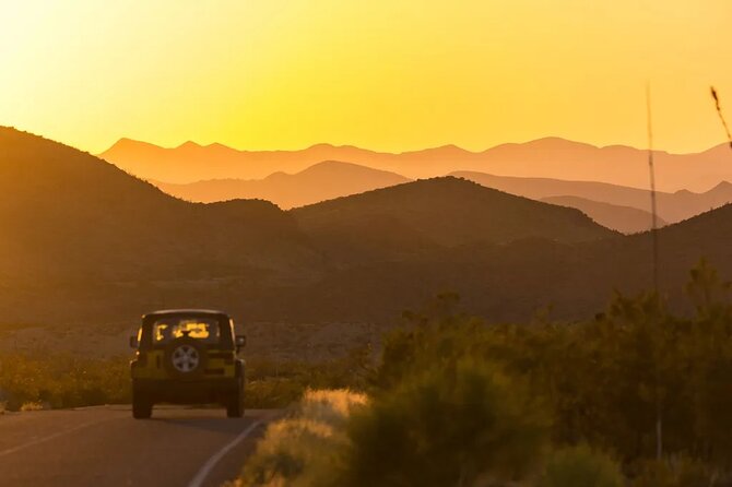
The last stretch brings you to water, villages, and the most international feeling part of the day.
Stop 15: Rio Grande Overlook gives you a simple, quick perspective above Rio Grande Village. You can see greenery around the river, which changes your sense of the landscape fast.
Stop 16: Rio Grande Village Visitor Center is about understanding the river and getting trail info, including guidance related to Boquillas Crossing. It also gives you ranger-level help, which is useful when conditions change.
Stop 17: Rio Grande Village Nature Trail is an easy 0.75-mile walk behind the campground. It starts with boardwalks through wetlands and then leads to the Rio Grande. This is a smart wildlife/birdwatching pick because wetlands often mean more activity—especially earlier or later in the day.
Stop 18: Boquillas Crossing is the big decision point. This official port of entry lets you cross legally into Mexico to visit the remote town of Boquillas del Carmen. The tour notes a typical time around 2 hours, plus a reminder to bring your passport. You can grab a meal and do light souvenir shopping once across the border.
Stops 19 and 20: Boquillas Canyon Overlook and Boquillas Canyon keep you in the canyon/border frame.
- Stop 19: Boquillas Canyon Overlook is about 5 minutes with a sneak preview over the Rio Grande and glimpses into Mexico and the town area.
- Stop 20: Boquillas Canyon is a 1.5-mile round trip hike with walls over 1,300 feet tall, and you stand at the border between the U.S. and Mexico. It’s described as easy except for a small hill at the very beginning.
This ending sequence is great because it turns the story of Big Bend into a real human boundary crossing—not just a distant canyon view.
What the Best Reviews Get Right: Flexibility, Easy Use, and Helpful Stories
This audio tour has a 4.9 rating from 12 reviews, with 100% recommended. The themes that show up clearly are practical wins: it helps the long driving feel interesting, it’s easy to run at your own pace, and it helps people visit places they might have skipped without guidance.
The design also fits real group travel. Because it’s built for your one vehicle/group, you avoid the stress of splitting up or waiting for someone behind at a trailhead. It’s also described as enjoyable for a wide age range, which makes sense: most stops are short, with optional hikes if you want more.
One fair caution: the app experience can be a little fussy if you pause and restart. Also, music quality can be personal—some audio soundtracks will land for you, others won’t. The good news is that you still get stories, directions, and stop context, even if the music isn’t your thing.
If you like to mix effortless sightseeing with a few meaningful walks—and you want stories while you drive—this is a strong fit.
Should You Book This Big Bend Self-Guided Audio Tour?
Yes, I’d book it if:
- You want a structured route without a strict schedule.
- You’re traveling with friends or family and want one cost per group (up to 15).
- You care about the “why” behind stops: ranch life, border communities, fossil displays, and canyon scale.
- You prefer short, flexible walks—plus optional hikes like Santa Elena and Chisos Basin—rather than one long grind.
I’d think twice if:
- You strongly want Tuff Canyon’s hike and can’t handle closure risk, since it’s listed as temporarily closed due to rock slides.
- You’re visiting when water crossings are likely to be messy, and you’d be disappointed if Santa Elena Canyon’s trail isn’t practical.
If you like your national parks with clear direction, offline confidence, and room to breathe, this is an easy yes.
FAQ
How much does the Big Bend self-guided audio tour cost?
It’s priced at $12.79 per group (up to 15 people).
How long does the tour take?
The tour takes about 8 to 9 hours, depending on which stops and hikes you choose.
Does the tour include Big Bend National Park entrance fees?
No. Park entrance is not included, and the information provided also notes a $30.00 entrance fee per booking.
What do I need to use the tour in the park?
You’ll use the Shaka Guide app. The tour includes an offline map and GPS guidance, so you don’t need continuous Wi-Fi or data once downloaded.
Will the audio play automatically while I drive?
Yes. The narration is designed to play automatically as you drive using GPS, with turn-by-turn directions.
Can I start the tour whenever I want?
Yes. The tour start is customizable, and you can follow the route at your own pace.
Are parking fees included?
No. Parking fees are noted as not included.
Do I need a passport for Boquillas?
Yes. The Boquillas Crossing stop notes that you must bring your passport to legally cross into Mexico.
What if a stop like Tuff Canyon is closed?
You can still keep going with the rest of the route since it’s self-guided. Tuff Canyon Overlook was noted as temporarily indefinitely closed due to rock slides.