REVIEW · ALBERTA
Yoho National Park Self-Guided Driving Audio Tour
Book on Viator →Operated by Guide With Action · Bookable on Viator
Yoho National Park feels big the second you start driving through it. This self-guided audio route turns a scenic drive into a story-by-story lesson on geology, history, and First Nations place names. You’re not stuck watching a slideshow from the passenger seat; the audio cues you by location.
What I like most is the mix of stops: you get viewpoints (like the Spiral Tunnel), big waterfall energy (Takakkaw Falls), and even a paleontology highlight (Burgess Shale). The other win is practical use: it’s offline after you download, and it plays automatically as you move along the route.
One thing to consider: you still need a Yoho National Park entry pass, and you’ll want decent phone setup time before you leave the hotel or parking lot. If your app isn’t downloaded or you don’t launch the tour at the starting point, the GPS-triggered audio can stall.
In This Review
- Key highlights you’ll actually notice
- How the GPS audio tour works in real life
- Price and timing: fitting Yoho into a short drive day
- Your route from Lake Louise area to Emerald Lake Road
- Stop-by-stop: what you’ll hear at each Yoho highlight
- Kicking Horse Pass: why the name matters
- Sherbrooke Lake Trailhead: solitude starts with a walk
- Lower Spiral Tunnel Viewpoint: the rail problem that got solved
- Takakkaw Falls: a seasonal detour worth the effort
- Wapta Mountain: a First Nations name in a European-shaped map
- Burgess Shale: fossils that change how you see time
- Natural Bridge: the river explains the shape
- Emerald Lake: Tom Wilson’s role in the finale
- Detours, hikes, and how to pace without rushing
- Phone setup and audio in the car: your quick checklist
- Who should book this self-guided Yoho driving tour
- Should you book it?
- FAQ
- How much does the Yoho National Park self-guided driving audio tour cost?
- How long is the tour, and how much driving is involved?
- Is Yoho National Park admission included in the tour price?
- Does the audio tour work without cell service?
- What do I need to do before I start?
- Where does the tour start and end?
- Can I pause the audio and resume later?
- What if the app or audio doesn’t work properly?
- Can I get a full refund if I cancel?
Key highlights you’ll actually notice
- Location-based audio that plays on its own so you don’t have to stare at your phone
- Offline maps and offline audio after downloading on strong Wi‑Fi/cellular
- A 50+ mile route with 27+ stories packed into about 1–2 hours of driving time
- Small-group value: $14.99 per group up to 4 people (cheaper than per-person tours)
- Stop variety from Kicking Horse Pass to Natural Bridge to Burgess Shale and Emerald Lake
- Hands-free pacing: start anytime, pause for photos, and skip anything you don’t care about
How the GPS audio tour works in real life
This is a classic “drive, listen, stop when it’s worth it” experience. After you book, you get a password by email/text and you load the tour app (Action’s Tour Guide App). You’ll need to download the tour while you’re on strong Wi‑Fi/cellular, because after that it’s designed to work without service.
Once you’re at the first story location, you open the app and start the tour. From there, the audio plays based on where you are, so you’re free to keep both eyes on the road and pull over only when you want a closer look. Each stop is built around a practical reason to stop—an overlook, a viewpoint, or an area that sets up the next story.
A small but important detail: the tour can be experienced at your own pace. That means you can linger for photos, stretch your legs, and take the longer walk if a trail is calling. Or, if you’re short on time, you can move on quickly and keep the momentum.
You can also read our reviews of more tours and experiences in Alberta.
Price and timing: fitting Yoho into a short drive day
The price is $14.99 per group (up to 4), which matters because national-park add-ons can add up fast. For a full car, that’s roughly $3.75 per person—often less than what you’d pay for a per-person shuttle or guided tour.
You’re looking at 1–2 hours to complete the route, and the drive covers over 50 miles with more than 27 audio stories. Plan your pace like this: you’ll likely spend around ten minutes at each main stop for the audio and a quick look, then add extra time if you decide to do a hike or linger at a waterfall.
Timing also depends on what’s open. Takakkaw Falls has a seasonal window: the road detour is only open July through September. If you’re visiting outside that stretch, you’ll want to count on the non-seasonal viewpoints and save Takakkaw Falls for another trip.
Your route from Lake Louise area to Emerald Lake Road
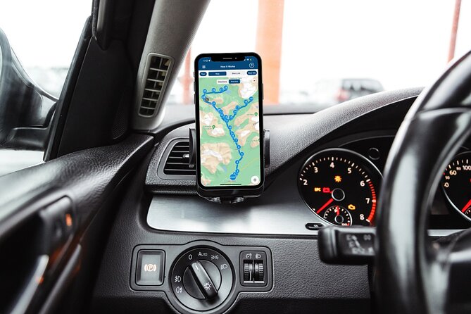
You start near Lake Louise (Alberta) at CRHF+Q24, and you finish at Emerald Lake Road near Field (British Columbia). That’s a nice setup if you’re already doing the Banff–Icefields area, because you can roll into Yoho without feeling like you have to plan an extra week.
The tour is offered in English and is listed as a private activity—just your group. It’s also described as being near public transportation, but practically, this is built for driving. The experience provider notes you can connect your phone audio through Bluetooth, USB, or AUX, and the playback is compatible with Apple CarPlay (with Android Auto support noted as on the way).
One more practical point: each stop is marked as admission ticket free, but Yoho National Park entry itself requires a pass, and it isn’t included in the tour price. So budget for that before you start.
Stop-by-stop: what you’ll hear at each Yoho highlight
Kicking Horse Pass: why the name matters
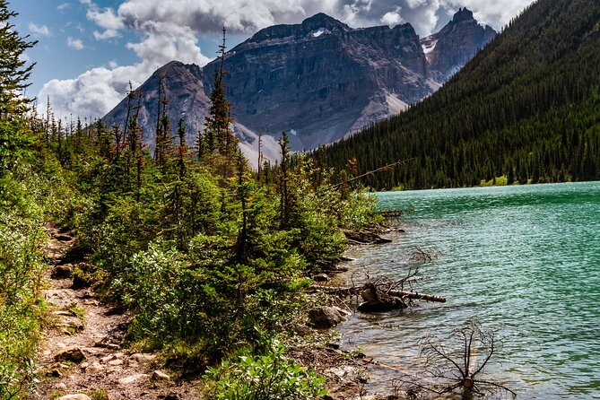
Your first stop is Kicking Horse Pass. The story points to the Kootenay people using this route long ago as they moved across the mountains on their way to Banff. Then it turns into the question you’ll keep hearing in your head while you drive: how did this pass end up with the name Kicking Horse?
This is a good opening because it frames the whole day. You’re not just looking at dramatic peaks—you’re learning how people moved through this terrain and how names stuck. It’s also a reminder that park stories aren’t only about recent tourism; the land has been traveled for a long time.
Sherbrooke Lake Trailhead: solitude starts with a walk
Next up is the Sherbrooke Lake Trailhead. The audio sets expectations clearly: this lake is meant to be rarely crowded, tucked at the base of two mountains, and the views are the point.
Here’s the reality check: the trail is described as six miles long and taking at least two hours. That’s longer than a quick photo stop, so if you’re time-limited, treat this as an optional commitment. If you’re the type who likes quiet and doesn’t mind a steady hike, this is one of the most rewarding places on the route.
Lower Spiral Tunnel Viewpoint: the rail problem that got solved
At the Lower Spiral Tunnel Viewpoint, the story shifts from nature to engineering. In the 1880s, Prime Minister John MacDonald and the Canadian Pacific Railway faced a major challenge: how do you get a steam-powered train with around 20 cars over mountains roughly 10,000 feet tall?
The audio explains how the railway had to solve thorny problems in order to make the transcontinental plan work. It’s a fascinating stop because it connects the region’s rugged geology to the human urge to cross it. You’ll look at the viewpoint differently once you know what the tunnel was trying to accomplish.
Takakkaw Falls: a seasonal detour worth the effort
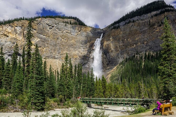
Ahead, you get an option: a detour to Takakkaw Falls. The audio calls out the scale—these falls tower at about 1,200 feet, and you can get surprisingly close to the roar.
The catch is the seasonal access. The road detour is only open July through September, and the detour takes around 15 minutes each way. So if you’re traveling in-season, this is one of your best “wow” moments. If you’re outside the open months, skip it without regret and focus on the core Yoho viewpoints instead.
Wapta Mountain: a First Nations name in a European-shaped map
At the Wapta Mountain moment, you’ll see the top of a peak at 9,114 feet. The story credits James Outram and J.H. Scattergood with the first climb in 1901, done with a Swiss guide.
Then the tone shifts to names. Many mountains here have European names, but Wapta is given as a First Nations name, and the audio prompts you to remember what wapta means in the Nakoda language. Even if you don’t know the meaning yet, the story plants a useful habit: pay attention to what the land was called before tourists arrived with their own labels.
Burgess Shale: fossils that change how you see time
By Mount Field, the tour highlights the Burgess Shale, described as one of Canada’s most important paleontological finds. You’ll hear what it is: a wide swath of sedimentary shale loaded with fossils.
This stop works best if you slow down slightly and look past the “pretty rocks” factor. Burgess Shale is famous because it reminds you that the mountains aren’t just scenery; they’re archives. You’re standing on rock that preserves evidence of ancient life, and the audio helps you connect that to what you’re seeing today.
Natural Bridge: the river explains the shape
The Natural Bridge viewpoint is where the tour gets almost detective-like. You’ll see a rock bridge spanning the width of the Kicking Horse River, and the story explains how it formed.
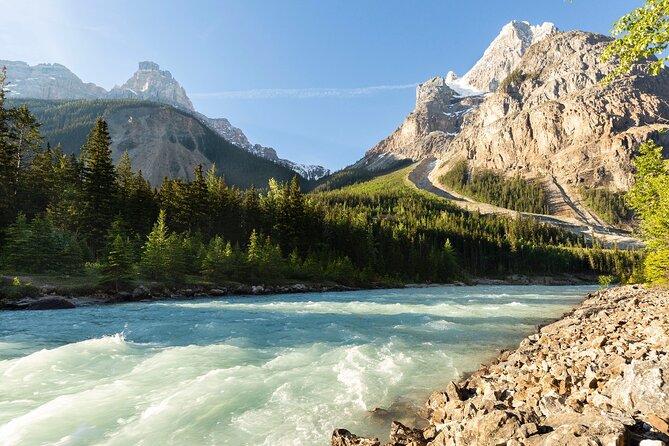
The key idea is the river’s behavior changes as it moves from flatter ground near Field to a steeper descent toward joining the Amiskwi River. Gravity speeds the flow and roughens it, shaping the rock over time. It’s a great stop for anyone who likes “why is it shaped like this?” answers, not just “look at that.”
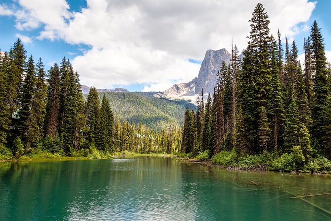
Emerald Lake: Tom Wilson’s role in the finale
Your final destination is Emerald Lake. The audio closes with Tom Wilson, described as the first European settler to lay eyes on this glacial lake and even name it. The story notes that historians are pretty sure he wasn’t making it up.
This ending is well-chosen because it ties together the day’s themes: travel routes (Kicking Horse Pass), access to remote places (Sherbrooke Lake), human problem-solving (Spiral Tunnel), and the way rivers and mountains create the scenery we come to see. Emerald Lake often ends up being the payoff moment—cool water, dramatic color, and that sense you earned the view.
Detours, hikes, and how to pace without rushing
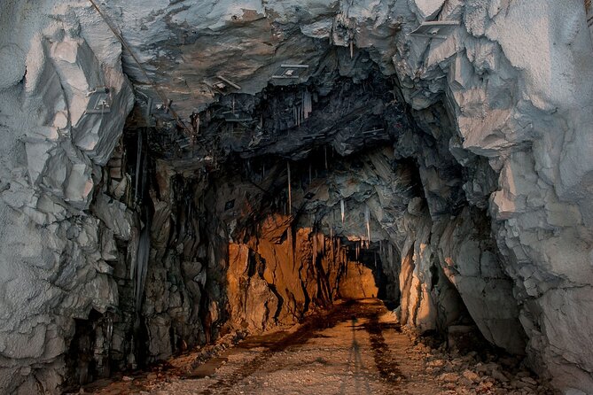
This route gives you options, and that’s the point. If you want a smooth drive, you can keep it mostly viewpoint-based and treat the route as an audio sightseeing loop.
If you want a more active day, you’ll likely spend more time at the trail end points—especially Sherbrooke Lake. The trail length and time estimate suggest it’s not a quick leg-stretcher, so plan your food and daylight the same way you would for any proper hike.
For photography, the audio timing helps you avoid the most common mistake: arriving at a viewpoint while you’re still trying to start the audio. If you want maximum enjoyment, download the tour early, then arrive at each stop with the audio already set to play once you’re in position.
Phone setup and audio in the car: your quick checklist
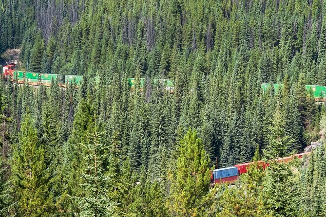
The tour is designed to be hands-free, but you still need a basic setup first. After booking, download the tour while you have strong Wi‑Fi/cellular, then you can rely on offline use.
When you’re ready to listen:
- Connect your phone to your car stereo via Bluetooth, USB, or AUX
- If you use Apple CarPlay, audio playback is compatible (navigation features are noted as coming soon)
- For Android, support via Android Auto is mentioned as on the way
- If you’re walking from a parking area to a viewpoint, consider headphones for better clarity
Device recommendations are listed too: iPhones on iOS 15+, Android devices on Android 9+, and iPads/tablets with GPS and cellular connectivity for navigation.
If something sounds off—like audio not starting when you expect—your first fix should be simple: make sure you launched the tour app at the starting point and that the tour was downloaded for offline use.
Who should book this self-guided Yoho driving tour
This is a great match if you:
- want a road trip style day with flexibility
- prefer learning at your pace, with the ability to stop for photos and then continue
- like geology and big natural features, not just travel trivia
- have a small group and want value per car rather than paying per person
It’s also a strong choice if you’re already doing the Lake Louise to Yoho corridor and want a structured way to see more than just one or two roadside pull-offs.
If you want a guided human to answer questions on the fly, this may feel limited. The advantage here is that you don’t need anyone to schedule you—you just follow the audio cues and drive.
Should you book it?
I’d book this if you want Yoho with less stress and more meaning. The route packs in the kinds of stops that usually require multiple turn-offs and lots of reading—then hands the context to you through audio, timed to where you are.
I’d hesitate if your trip depends on perfect tech. You’ll need to download correctly, launch at the right starting point, and have phone audio set up in the car. And remember: you still must purchase the Yoho park pass separately.
If you’re ready to drive, listen, and stop when the views earn it, this is a solid value way to see Yoho beyond the basics.
FAQ
How much does the Yoho National Park self-guided driving audio tour cost?
It costs $14.99 per group, up to 4 people.
How long is the tour, and how much driving is involved?
The route is about 1 to 2 hours to complete and is over 50 miles long, with more than 27 audio stories.
Is Yoho National Park admission included in the tour price?
No. Park passes are required to visit Yoho National Park, and they are not included.
Does the audio tour work without cell service?
Yes. It includes offline maps and is designed to work without cellular or Wi‑Fi after you download the tour.
What do I need to do before I start?
After booking, you’ll receive an email/text with setup instructions and a password. You should download the tour while you have strong Wi‑Fi/cellular, then launch the tour app once you’re onsite.
Where does the tour start and end?
It starts near Lake Louise, Alberta at CRHF+Q24 and ends at Emerald Lake Road near Field, British Columbia.
Can I pause the audio and resume later?
Yes. You can start anytime and pause anywhere, using the tour at your own pace.
What if the app or audio doesn’t work properly?
If you face audio issues, contact support. The notes also emphasize downloading beforehand and launching the tour at the starting point so the GPS-based audio can trigger correctly.
Can I get a full refund if I cancel?
Yes. You can cancel up to 24 hours in advance for a full refund. If you cancel less than 24 hours before the start time, it isn’t refunded.