REVIEW · INDIANA
Indiana Dunes National Park Self-Guided Audio Tour
Book on Viator →Operated by Shaka Guide Apps · Bookable on Viator
A stop here changes how you see dunes. This self-guided audio tour turns Indiana Dunes National Park into a story you can follow at your own pace, with GPS-activated narration and offline maps that keep you moving.
Two things I really like: it’s one ticket for your whole group (up to 15), and the route is built around what makes this area special beyond the big dunes—birds, shifting sand, and real places people have lived.
One possible drawback to plan for: you’re relying on your phone and GPS. If the app has a glitch, you may lose time or get routed around longer drives than you expected, so it helps to keep a simple backup plan (like checking a park map on your phone before you start).
In This Review
- Key highlights you’ll actually feel during the drive
- Price and value: $15.99 per group, not per person
- Setting up Shaka Guide so the route feels smooth
- From Westville to Gary: how the GPS narration shapes your day
- Heron Rookery Trail: a peaceful start even without the famous herons
- Mt. Baldy’s wandering dune: stairs, sand, and why tourists changed everything
- Central Beach: bird activity, accessible restrooms, and a no-lifeguard reality
- Great Marsh Trail: an easy hike plus a separate paved route to an observation deck
- Lake View Beach: a short stop with spring smelt snack energy
- Century of Progress houses: when the World’s Fair became a real neighborhood
- Dunbar Beach and Kemil Beach: restrooms, night-sky potential, and swim caution
- Little Calumet River Trail: imagine the shoreline that used to be here
- Glenwood Dunes Trail system: oldest dunes in the park, but bring a map
- Visitor Center stop: films, rangers, and an Indigenous Cultural Trail
- Indiana Dunes State Park: busy parking, a separate fee, and 3-Dune challenge vibes
- Porter Beach: a simple overflow option when the State Park lots are full
- Cowles Bog Trail: moderate hike, steep dune climbs, and a real ecology story
- Bailly Cemetery and Bailly Homestead: when odd history turns into walkable context
- Chellberg Farm: Swedish immigrant life, maple syrup culture, and ranger programs
- Mnoke Prairie: restored tallgrass with birdwatching payoff
- Portage Lakefront and Riverwalk: spring birds, winter ice, and easy walking
- Tolleston Dunes Trail: moderate effort with shade and cactus details
- West Beach, Diana’s Dune, and the 270-step climb to see succession in action
- Marquette Park and the Gary Bathing Beach Aquatorium
- Paul H. Douglas Center: environmental education plus a short loop hike
- Beach and trail safety notes that matter here
- Should you book this Indiana Dunes self-guided audio tour?
- FAQ
- How much does the Indiana Dunes self-guided audio tour cost?
- How long is the tour?
- Does the tour work offline?
- What does the tour include?
- Are beach swimming and hikes supervised by lifeguards?
- Are entrance fees and parking included?
Key highlights you’ll actually feel during the drive
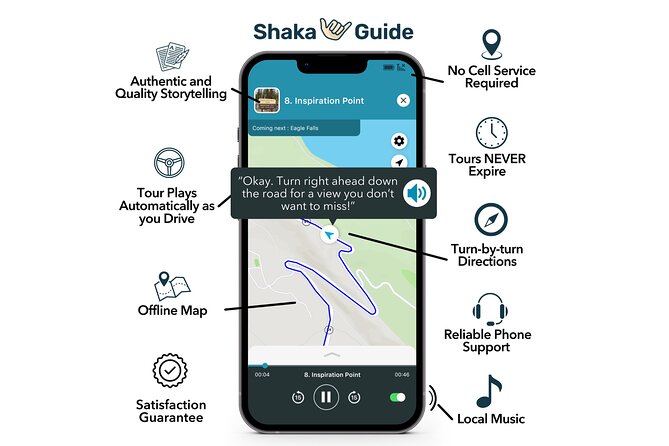
- Automatic narration tied to your location so you’re not hunting for audio controls every few minutes
- Offline map access (you still download first with Wi‑Fi) so you’re not stuck if cell service drops
- Real dune science and human history mixed together, from a moving dune to Chicago World’s Fair houses
- Lots of short stops that work even if you don’t want to do one long hike
- Beach safety reminders built into multiple stops since there are no lifeguards at several swimming areas
- A route that hits Indiana Dunes and then spills into Gary for extra context and different views
Price and value: $15.99 per group, not per person
The big value here is pricing logic. At $15.99 per group (up to 15 people), you’re paying once for the vehicle experience, not per traveler. That can make a huge difference for families, mixed-age groups, or anyone splitting costs between cars.
You also get a full approx. 12-hour self-guided experience. Since you can pause and resume, you’re not stuck doing a strict schedule. You’ll still want to budget time for walking between stops—some are a few minutes, but a few are longer hikes and stair climbs.
Plan on this not covering everything. Entrance fees and parking fees aren’t included, and most food isn’t included either. The tour is the guide in your pocket: narration, directions, and stop context.
Setting up Shaka Guide so the route feels smooth
This works best when you do a little prep before you leave home.
- Download the tour on a strong Wi‑Fi connection first, then use the offline map while you’re out there.
- When you’re ready, you open the app, go to My Stuff, choose the tour, then start at 5648 US-6, Westville, IN 46391.
- The audio is designed to play automatically as you drive, with GPS turn-by-turn directions, so your job is mostly to drive slow enough to read signs and pull into lots safely.
A practical tip: bring a phone charger. Long scenic drives plus map use plus audio is a battery workout, especially if your signal is weak and your phone keeps searching.
From Westville to Gary: how the GPS narration shapes your day
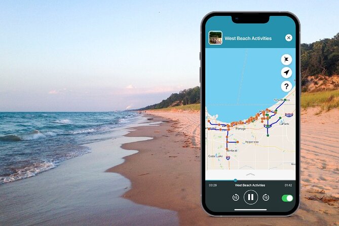
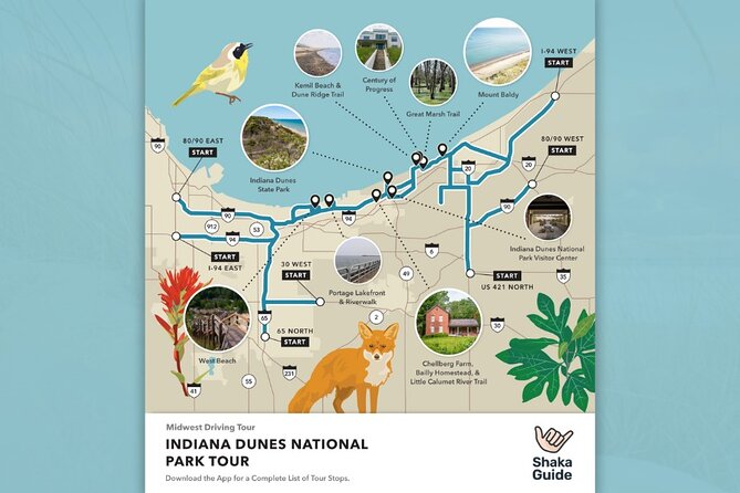
The route ends at N Lake Street, south of the Paul H. Douglas Center for Environmental Education in Gary. That matters because you’re not just touring one beach area. You’re building a full-day loop that connects dunes, trails, historic sites, and environmental education.
The narration approach is the real magic trick. Instead of driving past “another beach” or “another trailhead,” you get the why behind what you see—like what a rookery is, why a dune can migrate, or what the Calumet shoreline used to mean.
Also, since it’s private for your group, you don’t have to wait for anyone else’s pace or keep up with a guide.
Heron Rookery Trail: a peaceful start even without the famous herons
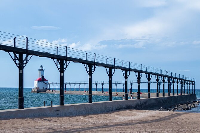
Start with an easy nature walk at Heron Rookery Trail Auxiliary (West) Lot. The walk is about 3.3 miles, and the point isn’t big elevation or dramatic views. It’s a quiet bird sanctuary concept: a rookery is a collection of nests high up in trees.
Here’s the twist: the Great Blue Herons moved to new grounds, so the rookery you expect may not be the one you see. Still, you might spot other birds such as kingfishers, warblers, red-headed woodpeckers, yellow-bellied sapsuckers, and more.
If you visit in spring, the narration helps you notice small things—Harbinger of Spring flowers and Yellow Trout Lilies, which are described as flower shapes that look a bit like banana peels.
Consideration: it’s calm and easy, but it’s not a guaranteed wildlife jackpot. If you want guaranteed big sights, you’ll get them later at the dune-and-beach stops.
Mt. Baldy’s wandering dune: stairs, sand, and why tourists changed everything
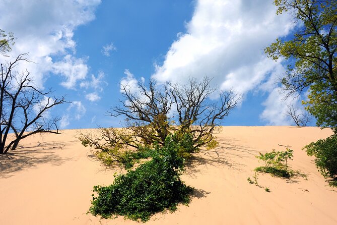
Next is Mt. Baldy, a standout because it’s basically a moving dune. The dune can shift up to 10 feet per year, and the reason given is human impact: grass that stabilized it was damaged from past climbing.
To reach the beach area, you do a half-mile roundtrip hike around the dune, and it includes stairs. That means you’re trading “drive-up and chill” for a closer look at how dune ecosystems shift.
Also, the story here is not just scenery. Mount Baldy is starting to overtake its own parking lot, which makes the dune feel alive and active rather than a fixed backdrop.
Central Beach: bird activity, accessible restrooms, and a no-lifeguard reality
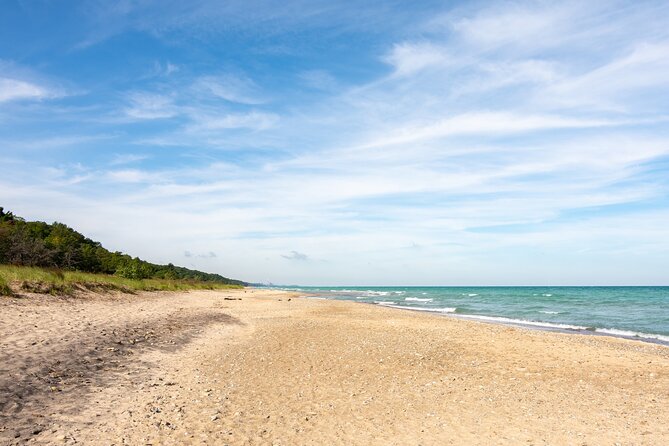
Central Beach is a classic mid-route break with practical upgrades: seasonal restrooms and potable water. You’ll also find picnic tables at the west end of the parking lot up the stairs.
Accessibility notes are mixed. Restrooms are wheelchair accessible, but the beach and picnic tables are not. If you need access for a wheelchair user, plan around the restroom access and the paved routes you can use nearby.
Safety is a must here. There are no lifeguards, and the guidance is clear: swim at your own risk, especially with rip currents and waves.
Seasonal bird life is a strong reason to stop in spring and summer. You can watch Bank Swallows come and go from nests in the dunes.
Great Marsh Trail: an easy hike plus a separate paved route to an observation deck
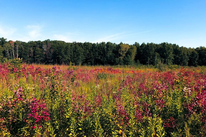
If you want birding that’s more forgiving than deep dune climbing, Great Marsh Trail is the move. It’s described as a nice, easy hike with views of the largest wetland complex in the Lake Michigan watershed.
What makes it feel more useful is the paired trail design: there’s a separate wheelchair-accessible paved trail with quick access to an observation deck. That gives you a way to see the marsh without committing to the longer route.
Bring your eyes. You’re looking for ducks, geese, herons, egrets, warblers, and red-winged blackbirds.
Lake View Beach: a short stop with spring smelt snack energy

Lake View Beach is quick at about 10 minutes in the tour rhythm, but it has a very specific seasonal claim: in spring it can be a good spot for smelt.
The narration doesn’t just say fish exists; it offers a cooking suggestion—smelt tastes great when shallow fried, dusted with flour, eaten whole. That’s not a reason to fish if local rules restrict it, but it does tell you the area’s flavor culture.
If you’re not there in spring, you’re still fine stopping for the lake air and the views. But the “smelt moment” is seasonal.
Century of Progress houses: when the World’s Fair became a real neighborhood
Then you hit something very different: 1933 Chicago World’s Fair Century of Progress homes. Five houses are part of a historic district that started at the 1933 fair, later purchased and moved here to create a community called Beverly Shores.
Here’s the key practical detail: the houses are owned by the National Park but leased to private residents, so you can’t go inside. You’re viewing from the outside unless you score tickets to an annual September tour.
This stop is for history fans, but it’s also a great way to break up the day if you’re feeling “all dunes, all day.”
Dunbar Beach and Kemil Beach: restrooms, night-sky potential, and swim caution
Dunbar Beach offers seasonal restrooms and potable water, plus a paved parking lot that can fill up fast on summer weekends. Like many beaches along the route, there are no lifeguards, so swimming is at your own risk.
Kemil Beach is built for a different kind of break. It has year-round restrooms and potable water, and it’s described as a solid spot for night skies and nocturnal animals.
Kemil also comes with something more active: the Dune Ridge Trail. This short nature trail is described as exceptionally diverse for its size, running over forested sand dunes, through Black Oak Savannas, and offering views of The Great Marsh and Lake Michigan. If you have time, this is one of the easiest “add-on” wins.
Again, no lifeguards. The caution is repeated because the water conditions can change fast.
Little Calumet River Trail: imagine the shoreline that used to be here
Little Calumet River Trail is a summer birding favorite and a winter skiers’ trail. The narration also gives you a timeline perspective that makes the hike more meaningful.
The big idea: the Calumet Dunes Ridge used to be the shoreline of Lake Michigan. In the last 12,000 years, the water receded about one and a half miles.
So when you walk the trail, you’re walking over old water ground, transformed by glaciers, wind, and time. That’s the kind of context that makes the scenery feel earned.
Glenwood Dunes Trail system: oldest dunes in the park, but bring a map
If you want a longer effort, Glenwood Dunes Trail is where the variety kicks in. Trails here range from under 1 mile up to 6.8 miles, with extensions pushing beyond 15 miles. There are 13 trail junctions, so you’ll want a trail map.
The standout science note: the Glenwood Dunes are the oldest dunes in the park, at about 13,000 years old.
This is also a good stop if your group has mixed energy. You can choose a short segment or commit to longer loops, depending on how much sand you want to wrestle.
Visitor Center stop: films, rangers, and an Indigenous Cultural Trail
At the Indiana Dunes Visitor Center, you get classic on-site support: educational displays, short films, a bookstore, and ranger help.
My favorite practical element here is the Indigenous Cultural Trail. It’s meant to honor the Potawatomi and Miami people who called this land home, and it’s framed around how closely they were connected to the area’s ecosystems.
If you want to learn fast before you start trudging around dunes, this is one of the best “prep stops” on the route. Ask a ranger for context so the later trails feel less random.
Indiana Dunes State Park: busy parking, a separate fee, and 3-Dune challenge vibes
The tour also includes Indiana Dunes State Park, which can get busy and may involve traffic directing by rangers. You should expect potential lines to get in, and—important—the state park has a separate fee.
If you’re into challenges, look for the 3-Dune hiking challenge and the Nature Center. If you want beach time, head straight to the sand.
There’s also an art deco park pavilion area with a general store and restaurants, plus a bird observatory west of the pavilion.
Seasonal extra: in winter, there’s a 100-foot sledding hill called The Devil’s Slide. History fans should also notice the historical marker for the 1780 Battle of Petit Fort site near the pavilion.
Porter Beach: a simple overflow option when the State Park lots are full
Porter Beach sits right next to the State Park beach but offers fewer amenities. The payoff is logistics: you can park here and walk about a quarter mile along the beach to the State Park.
No lifeguards here either. Seasonal restrooms are available at the parking lot.
This is a smart stop for anyone who hates “parking lottery” stress.
Cowles Bog Trail: moderate hike, steep dune climbs, and a real ecology story
For a more rugged nature experience, Cowles Bog Trail is described as moderate at 4.7 miles with 202 feet of elevation gain. It’s rugged with steep dune climbs in loose sand.
The science angle is the point. Cowles Bog is named after Doctor Henry Cowles, and his research helped shape the idea of Indiana Dunes as the birthplace of ecology. If you like nature to have explanations—this is the stop.
Bailly Cemetery and Bailly Homestead: when odd history turns into walkable context
Two close-in history stops round out the tour’s theme that this area wasn’t only dunes.
Bailly Cemetery is a unique shortcut hike: less than half a mile roundtrip into woods to see an old cemetery and hear the story of how one family took over and made it their own.
Then comes Bailly Homestead, a National Historic Landmark home of Joseph and Marie Bailly. Joseph was an early settler who established a trading post in 1822. At one time, the homestead served as a key stop between Chicago and Detroit.
The homestead is a cluster of five buildings, ranging from rustic log cabins to brick structures and a late 19th-century main house. You can’t treat this as a quick photo stop. It rewards readers who like to understand how people lived here.
Chellberg Farm: Swedish immigrant life, maple syrup culture, and ranger programs
Chellberg Farm tells a straightforward American story through specifics. The Chellbergs were Swedish immigrants who purchased land in 1869. Their original farmhouse burned in 1884, and they replaced it the next year with the brick house you can see.
In the 1930s, they began making maple syrup. The narration points you to the syrup shack on the way to the farm, and it highlights a very unusual claim: this is the only National Park in the country that makes its own maple syrup.
There’s also a reminder to check the park website calendar for ranger programs. The tour notes that ranger programs may include tours of the old farmhouse and opportunities to feed animals like cows, chickens, and goats.
Mnoke Prairie: restored tallgrass with birdwatching payoff
Mnoké Prairie is a restored pre-settlement tallgrass prairie, and you walk through what it would have looked like before European-American settlers arrived.
Birdwatching is a major cue. You might spot double-breasted cormorants, rock pigeons, and Cooper’s hawks. Since prairies can feel open and exposed, this stop is best when you’re ready to watch rather than just hike.
Portage Lakefront and Riverwalk: spring birds, winter ice, and easy walking
The Portage Lakefront and Riverwalk works for different seasons. In spring and summer it’s good for bird observation; in winter you might see shelf ice on Lake Michigan.
The riverwalk is just under a mile and considered easy, so it’s a great reset if you’ve done sand climbs earlier. You’ll also find a beach pavilion with snacks, gifts, restrooms, and ranger programs.
Tolleston Dunes Trail: moderate effort with shade and cactus details
At Tolleston Dunes Trail, you’re walking through dunes described as nearly 5,000 years old. The trail is about three miles long and goes up and down, making it moderately difficult.
After rain, it can get soggy. The good news is trees provide shade, so it doesn’t always feel like a sun-bleach hike.
The narration also calls out plants to watch for: prickly pear cactus, sassafrass, and wild blue lupine.
West Beach, Diana’s Dune, and the 270-step climb to see succession in action
The route includes West Beach, described as the biggest and busiest beach in the national park. It’s a true mixed-use stop for sunbathing, swimming, beachcombing, and birdwatching.
There are hiking connections too, including the Long Lake Loop through forests, wetlands, and rolling sand dunes. If you want the big physical challenge, there’s Diana of the Dunes Dare, with a one-mile Dune Succession Trail that includes a strenuous climb of 270 steps to the top of Diana’s Dune.
This is a great stop to decide your day’s mood. If you want a workout, do Diana’s Dune. If your feet are tired, stick to the easier loops and beach time.
Marquette Park and the Gary Bathing Beach Aquatorium
The tour route also includes Marquette Park in Gary, outside the National Park. It has a playground, a concession stand, hiking trails, and even a disc golf course.
For a different visual cue, the Gary Bathing Beach Aquatorium was built in 1921. If you’re interested in how beach culture evolved, this brief city contrast makes the dunes feel even more rooted in real coastal life.
Paul H. Douglas Center: environmental education plus a short loop hike
The tour ends at the Paul H. Douglas Center for Environmental Education in Miller Woods. It has exhibits on wildlife across the park and hiking trails.
The highlight recommended here is the Miller Woods Loop Trail, under a mile and described as meandering through several habitats with incredible lake views. This is a strong way to finish: you get a final nature dose plus a place to wrap your day with context.
Beach and trail safety notes that matter here
A lot of the tour’s appeal is that you’re out at the water, and that means you should treat safety as part of the experience, not an afterthought.
- Many beaches on this route explicitly say no lifeguards, and swimming is at your own risk, with rip currents and waves mentioned.
- Some beach access is limited for mobility needs. For example, Central Beach has wheelchair-accessible restrooms, but the beach and picnic tables are not wheelchair accessible.
- Sand hikes often involve stairs or loose footing. Stops like Mt. Baldy and Cowles Bog come with terrain challenges, even when the walk time sounds manageable.
Should you book this Indiana Dunes self-guided audio tour?
Book it if you want a guided-feeling day without a group schedule. The GPS-activated narration is built to turn a drive and a sequence of short stops into something you understand: moving dunes, bird habitat, and the human timeline from homesteads to World’s Fair houses.
Skip it or at least go in with a backup plan if you’re very dependent on your phone working perfectly. If the audio app fails mid-route, you’ll be forced into your own navigation and you may feel like you lost time.
If you’re traveling with multiple interests—birds, history, dunes, and beaches—this tour fits. It doesn’t force one style of fun. You can choose more hiking or more lounging, and still come away with better context than you’d get from driving straight to the sand.
FAQ
How much does the Indiana Dunes self-guided audio tour cost?
It’s $15.99 per group, up to 15 people.
How long is the tour?
The duration is listed as approximately 12 hours.
Does the tour work offline?
You get an offline map with the tour, and you don’t need continuous wifi or data while using it. You may need strong Wi‑Fi to download the tour before you start.
What does the tour include?
It includes hours of audio narration with stories, travel tips, and music, GPS turn-by-turn directions, tour highlights with activity and restaurant recommendations, an offline map, and the ability to use the tour any day since tours never expire.
Are beach swimming and hikes supervised by lifeguards?
No. Several beaches on the route state there are no lifeguards, and you should swim at your own risk due to rip currents and waves.
Are entrance fees and parking included?
No. Entrance fees and parking fees are not included.